Environmental / Architects / Land Development / Contractors & Developers
Inspections / Real Estate / Golf / Adventure Tourism / Landscaping
Working alongside our drone pilot while observing a livestream of drone’s camera on a monitor helps to ensure we get the exact imaging you are looking for. Livestreaming works for so many different applications and is a great way to save time and money.
This kind of communication and idea-sharing provides accurate, high-resolution digital information for project meetings, precision imaging needed for inspections and surveying, as well as high-resolution imaging for websites and advertising.
If you have a multi-day project, give us a proposal of what you would like DroneWorX to do, and we will see if we can help meet your requirements.
Adventure Tourism
Our drones use 6x zoom to capture 4K video from a safe distance without disrupting your guests’ outdoor adventure.
Guests stay fully engaged in the moment while we capture high-resolution images from multiple angles for lasting memories.
No interruptions, just professional, cinematic footage of their thrilling journey through nature or extreme terrain.
Architects (Structural and Landscaping)
Capture critical site data with high-resolution aerial imaging to support your architectural planning, budgeting, and design accuracy.
Use bird’s-eye views to visualize site layout and structure placement before breaking ground or finalizing project details.
Enhance presentations with cinematic fly-throughs, close-ups, and confined space imaging, all in sharp 4K video and high-resolution stills.
Showcase completed projects from every angle to impress clients and strengthen your architectural portfolio with compelling visuals.
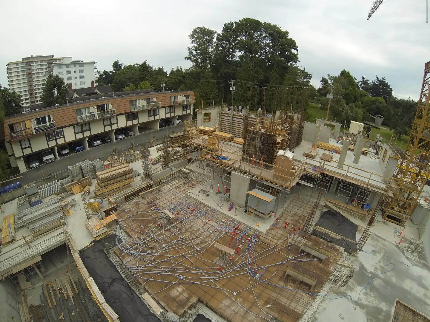
Contractors & Developers
Not only do our drones capture 4k videos and images of a building’s structure, the 4k video also provides a digital document of the mechanical, plumbing, and electrical installation inside of interior walls before being drywalled.
This imaging can help a supervisor to monitor progress, it’s all on video.
Environmental
DroneWorX offers two different ways to view livestreaming: By viewing on a Monitor or by wearing FPV goggles (basically, virtual reality googles). Livestreaming allows you to communicate directly with our drone pilot so they can maneuver the drone to capture accurate detailed imaging with lots of information. This will help cut project cost and is a lot safer and faster than the alternative.
Drones offer a fast, safe method for monitoring environmental and remediation projects and help in planning riparian and SPEA area risk management. Aerial imaging is very useful to collect imaging of plants in an area.
Our drones are able to fly through trees instead of over tree tops, helping make sure we don’t miss any important information and helping to reduce any potential hazards that someone on foot might encounter.
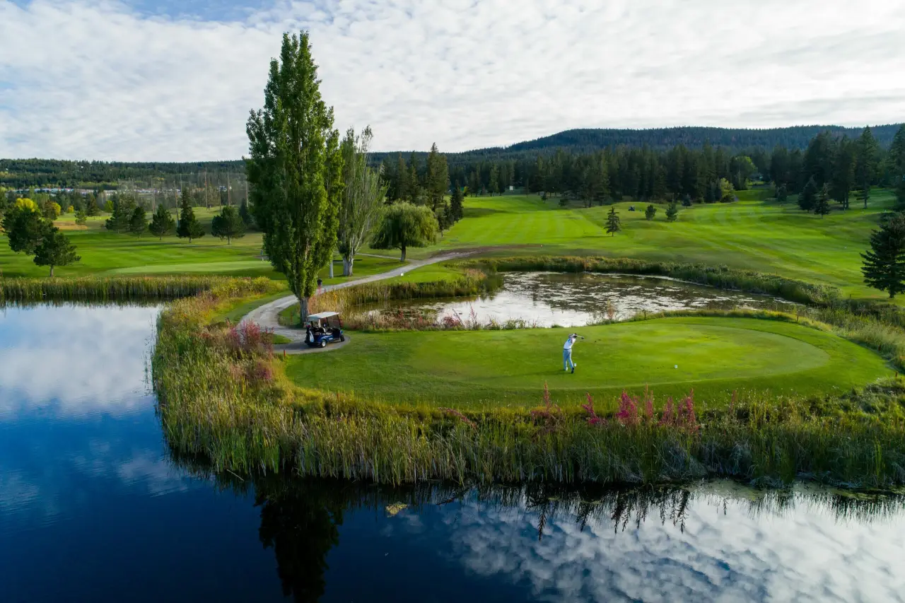
Golf
In about five minutes per hole, our drones capture detailed high-resolution aerial imaging and stunning 4K video from multiple angles. This provides comprehensive visual coverage of fairways and greens for golf course analysis and marketing.
Flying approximately 10 feet above the fairway reveals how it plays from the tee to the green. With this detailed aerial perspective golfers benefit from a clearer understanding of each hole’s challenges, enhancing their playing experience.
At the green, flying 2 to 3 feet above the fringe allows you to clearly see slopes, breaks, and contours that affect putting performance. Circling the green from about 10 feet above captures its full layout, providing a clear view of the green’s shape and flow.
Aerial imaging helps potential golfers and clients understand yardage and green flow, which is vital for player strategy and engagement. The bird’s-eye views of fairways and greens also support promotional efforts, giving your course a professional and visually appealing presence online.
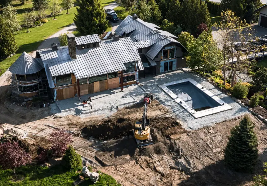
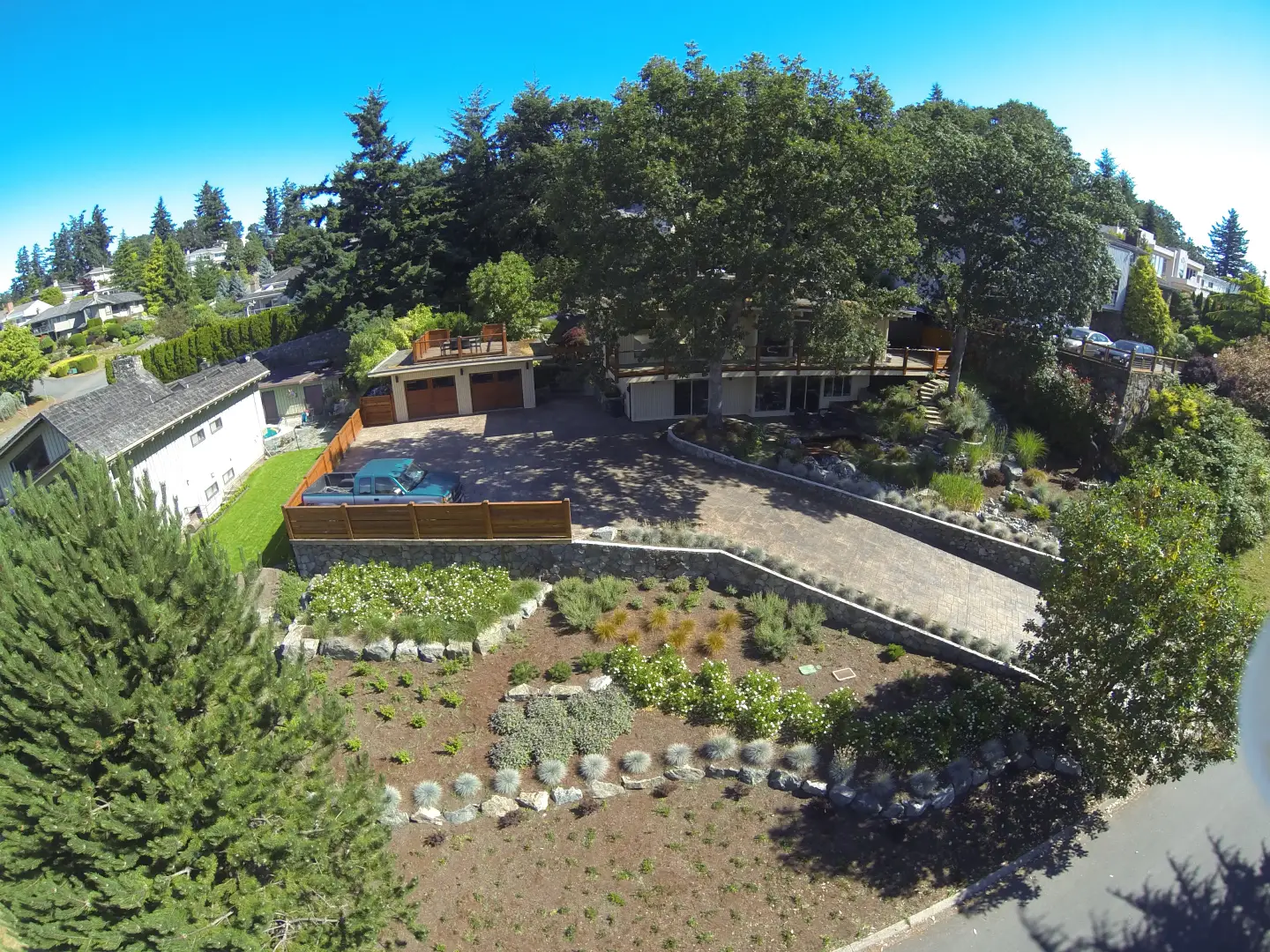
Land Development
Explore your land safely and efficiently with our FPV (First-Person View) drone technology or watch and idea-share with our drone pilot via a monitor.
Drones are a very good way for developers to get full and detailed information at the start of a project. This allows for accurate site assessments, faster land prep planning, and better budget forecasting.
Drone scouting over rough or wooded terrain is not only faster, but also significantly safer. It’s the smartest way to plan your land development project.
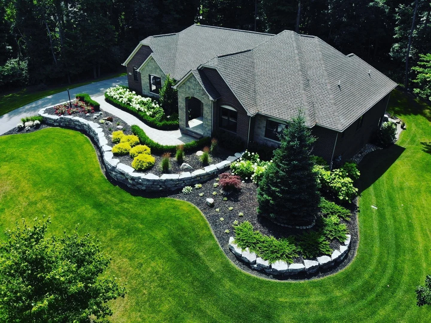
Landscaping
Use bird’s-eye drone imaging to scout property and visualize site layout before breaking ground. This overhead perspective supports early-stage design planning and helps generate creative development ideas.
Throughout construction, aerial monitoring offers a reliable way to track progress and identify issues early. Once the project is complete, professional aerial footage beautifully showcases the finished result.
Including drone imagery in your client estimates adds value and strengthens your proposal with compelling visual insights.
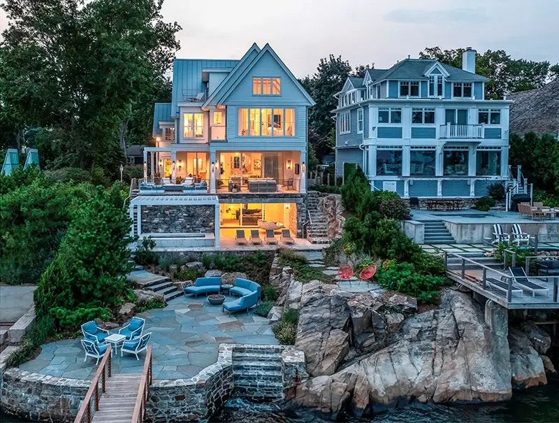
Real Estate
How does our fixed pricing help and what are its benefits?
DroneWorX offers a fixed pricing system; for example, you purchase a 4-hour or 6-hour imaging package which includes travel, set up, production and imaging.
We shoot as much aerial imaging as we can inside that package’s timeline. A 4- or 6-hour package can be used over multiple properties.
One benefit may be realtors with listings in the same area purchasing a package together to cut down on costs.
Inspections
All DroneWorX professional services provides our clients with use of a monitor or FPV goggles to get the best imaging the first time. Because you are able to communicate directly with our drone pilot, we can collect accurate detailed imaging full of information. It’s also faster and often safer than other alternatives methods of inspection.
Some examples: scanning the exterior of buildings and various other types of structures, residential and commercial roof tops, including roof top mechanical equipment, tight spaces and buildings under construction.
Ready to get started? Contact us today to discuss your project and request a quote.
What does a drone production look like?
The 4-hour package includes travel time, drone station set up, a walk-through for Transport Canada safety paperwork, a project meeting, and aerial imaging & production. The 6-hour package provides the same workflow with additional travel time or more minutes of dedicated aerial imaging and video production.
What is aerial imaging production time?
Production time is the dedicated time spent reviewing the video imaging on-site to determine if additional angles or specific shots are required to achieve the project goals.
What is the maximum height a drone can fly?
Under Transport Canada regulations, our standard flight ceiling is 400 feet (122 meters) above ground level. This height is more than sufficient for high-end real estate videography and professional industrial infrastructure inspections.
Can I use a 4 or 6-hour package over several projects?
Yes, you have hired DroneWorX for the full 4 or 6-hour block. We will capture as much imaging as possible for you across your various project needs within that allotted time frame.
What kind of weather can you fly in?
Our drones are not waterproof, so we prefer dry days. We aim for some sun to ensure optimal lighting, though we can use post-production to enhance quality on cloudy days.
Do you offer rain checks for scheduled imaging?
Yes. For weather postponement due to inclement weather, DroneWorX will make every effort to accommodate rescheduling as long as there are no scheduling conflicts.
How do I receive my drone footage?
Because 4K drone footage results in very large files, we provide a secure, high-speed download link via Dropbox or Google Drive. An SD drive for video can also be included as part of the price.