Working directly with the drone pilot and following via livestreaming on a monitor allows for detailed communication and idea-sharing. This provides the most accurate high-resolution imaging needed for websites and advertising. Livestreaming helps reduce cost and time by decreasing the need for multiple shoots – Efficient & Cost Effective.
Our business platform, pricing structure and flexibility is designed around working with small business. DroneWorX provides imaging with digital information that is more than just an image – it tells a story.
DroneWorX captures imaging from different low elevation angles often in areas that a photographer just can’t get to because of safety reasons (see gallery).The perfect imaging can be the difference of feet and from a hard to get at angle.
For projects on a budget, give us a proposal of what you would like DroneWorX to do, and we will see if we can help meet your requirements.
Website Packages

Hourly Rates
$200 dollar minimum first 2 hours $75 per hour after 2 hours
4-hour Package
$299.00
Includes 30 minutes of image cropping
- Travel Time – Setup – Safety – Paperwork
- Production
- Video & Photo Aerial Imaging
- Video clean-up
6-hour Package
$499.00
Includes 1.5 hours post production
- Travel Time – Setup – Safety – Paperwork
- Production
- Video & Photo Aerial Imaging
- Basic Editing / Post Production
Travel Expenses
Hotels, ferries, project add-ons need to be evaluated and added to projects cost on contract. Extra production time can be discussed when needed.
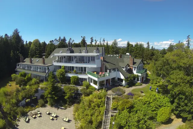
Accommodations
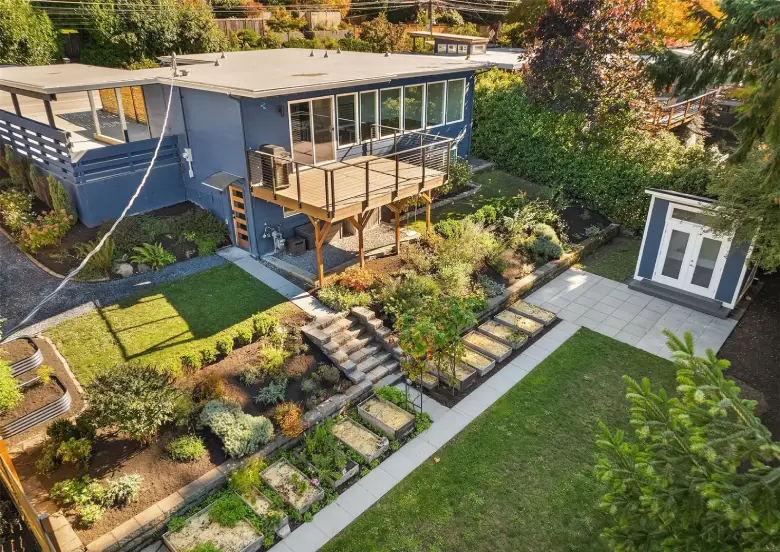
Aerial imaging provides a stunning bird’s-eye view of your property and surroundings, along with low-elevation drone flights around buildings and land. The result feels like a virtual walkthrough, captured from multiple angles and elevations for a dynamic and immersive perspective.
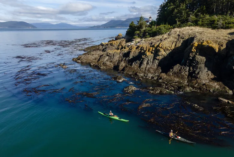
Adventure Tourism
Let us capture professional aerial imaging that showcases what your company offers, helping potential clients visualize your services and value.
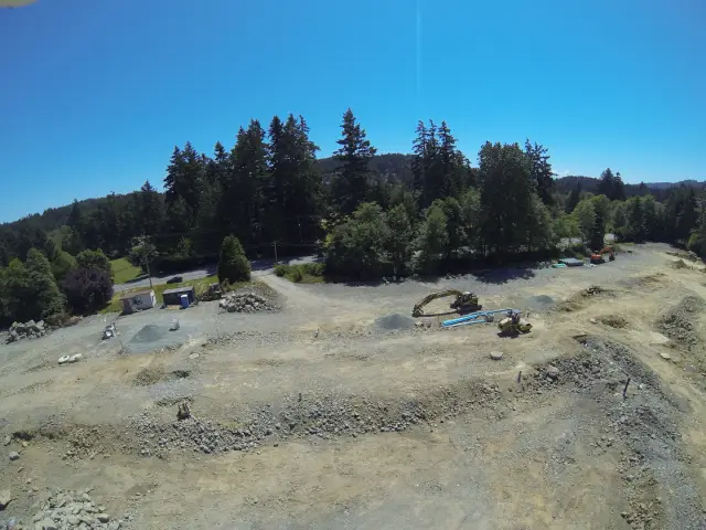
Construction Companies / Builders
Use aerial imaging to showcase your past and current projects, highlighting the architecture and design of your completed work.
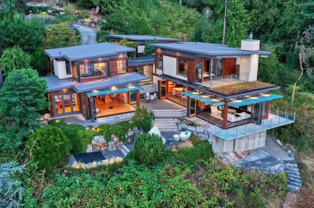
Developers
Use aerial imaging to showcase past and current projects with stunning detail. Our aerial imaging captures multiple angles and elevations, delivering high-resolution photos and 4K video.
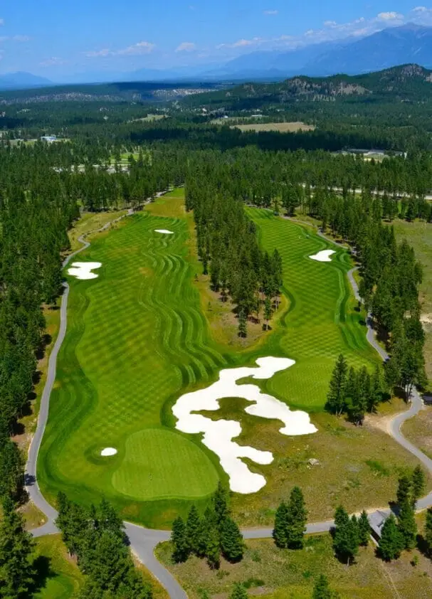
Golf
In about five minutes per hole, our drone captures high-resolution aerial imaging and 4K video from multiple elevations and angles, providing detailed views of fairways and greens. Flying approximately 10 feet above the fairway reveals how it plays from tee to green. At the green, flying 2–3 feet above the fringe all around helps visualize the contours and slopes. Circling the green at 10 feet captures the overall layout, giving you a comprehensive perspective of the terrain.
Landscaping
Use aerial imaging to showcase past projects and attract potential clients. Our aerial imaging captures multiple elevations and angles in stunning 4K video and high-resolution photos. Use aerial imaging to showcase past projects and attract potential clients. Our aerial imaging captures multiple elevations and angles in stunning 4K video and high-resolution photos.
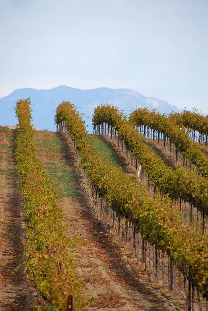
Wineries
Experience FPV (First-Person View) drone flights through the vines from multiple angles, capturing dynamic aerial views. We also fly through processing areas and grounds, delivering comprehensive coverage with stunning 4K video and high-resolution imaging.
Web Design & Post Production by Evolutionweb.ca